
Typhoon Dolphin, 13th of the Season, to Reach Peak Intensity on the 31st with Strength Level 5 and Maximum Wind Speed of 58m/s... Projected Path
According to the expected track of Typhoon Dolphin, the 13th typhoon of the season, announced by the Korea Meteorological Administration (KMA) at 4:00 a.m. on t
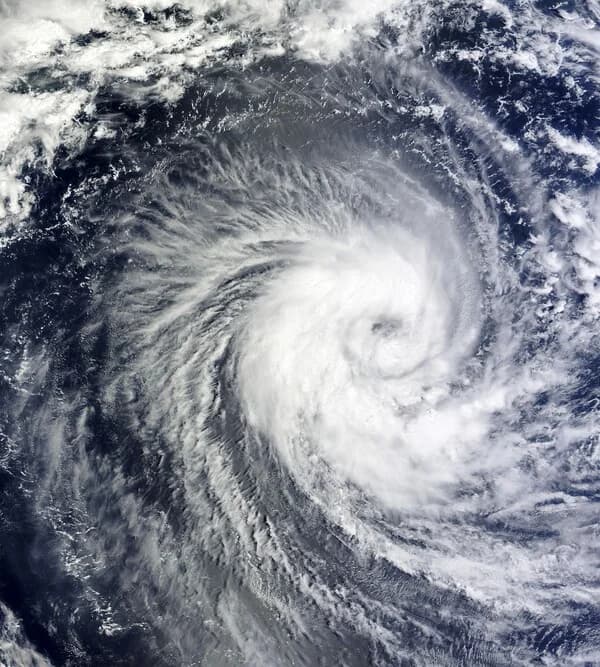
According to the expected track of Typhoon Dolphin, the 13th typhoon of the season, announced by the Korea Meteorological Administration (KMA) at 4:00 a.m. on the 30th, the typhoon is forecast to move northward while gaining strength into early next month after forming at 3:00 p.m. on July 27.
Current Position and Intensity
As of 3:00 a.m. on the 30th, Typhoon Dolphin is classified as 'very strong (level 5)' and is located on waters approximately 2,380 km east of Guam with a maximum wind speed of 53 m/s (191 km/h). By 3:00 p.m. on the same day, it is expected to strengthen slightly with a maximum wind speed of 56 m/s (202 km/h) and move to waters about 2,190 km east of Guam.
Peak Intensity on the 31st... Wind Speed Reaching 58 m/s
At 3:00 a.m. on the 31st, Typhoon Dolphin will reach a maximum wind speed of 58 m/s (209 km/h), displaying its strongest intensity within this forecast period, as it passes through waters approximately 2,010 km east-northeast of Guam. By 3:00 p.m. on the same day, it is projected to maintain intensity level 5 and a maximum wind speed of 58 m/s while reaching waters about 1,840 km east-northeast of Guam, meaning peak intensity conditions will persist for nearly a full day.
Gradual Weakening Trend Thereafter
Afterward, the typhoon is expected to transition into a gradually weakening trend.
- August 1, 3:00 a.m.: Maintains intensity level 5, maximum wind speed of 56 m/s (202 km/h), approximately 1,700 km east-northeast of Guam
- August 2, 3:00 a.m.: Weakens one level to intensity level 4, maximum wind speed of 55 m/s (198 km/h), approximately 1,450 km northeast of Guam
- August 3, 3:00 a.m.: Maximum wind speed of 53 m/s (191 km/h), approximately 1,300 km northeast of Guam
- August 4, 3:00 a.m.: Maximum wind speed of 49 m/s (176 km/h), approximately 1,310 km north of Guam
Impact on the Korean Peninsula to Be Monitored
This forecast is based on data as of 4:00 a.m. on July 30, and the actual track and intensity of the typhoon may change according to subsequent KMA announcements. In particular, as the forecast points move closer to waters north of Guam heading into early August, it is necessary to continuously monitor whether the future track will be adjusted toward the Korean Peninsula.
[This article was written for informational purposes based on the expected track data released by the Korea Meteorological Administration. Please verify actual weather conditions through the KMA's latest announcements. This article was written with AI assistance.]
CBC Globe publishes verified stories with editorial review, source checks, and tenant-specific publication standards.
Related Articles
![[Video] aespa's Ningning Attends 'Gucci Edit Room' Pop-up Event...Dazzles with Goddess Beauty](/_next/image?url=https%3A%2F%2Fmedia.cbcglobe.com%2Ftenants%2Fcbc00000-0000-4000-8000-000000000001%2Fmedia%2Fcbc%2F2026%2F07%2F593162%2F03b368b825ad1f50%2Fvariants%2Fhero.webp&w=1920&q=75)
[Video] aespa's Ningning Attends 'Gucci Edit Room' Pop-up Event...Dazzles with Goddess Beauty
![[Video] Actress Lee Young-ae Attends Gucci Pop-up Store Event at Shinsegae Department Store Gangnam... 'Elegant Beauty'](/_next/image?url=https%3A%2F%2Fmedia.cbcglobe.com%2Ftenants%2Fcbc00000-0000-4000-8000-000000000001%2Fmedia%2Fcbc%2F2026%2F07%2F593167%2F57eb2d937940f18f%2Fvariants%2Fhero.webp&w=1920&q=75)
[Video] Actress Lee Young-ae Attends Gucci Pop-up Store Event at Shinsegae Department Store Gangnam... 'Elegant Beauty'

"Earned Income Tax Credit Late Application Deadline December 1… Business Income Earners Cannot Apply for Half-Year Period, Please Note"